
Address
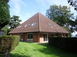
Carmelite Retreat Centre
Oxford
OX1 5HB
England
How to find the Carmelite Priory
 Address of centre:
Carmelite Retreat Centre, Chilswell, Boars Hill, Oxford. OX1 5HB. Tel 01865 321991 www.carmelite.org.uk.
Getting a taxi from Oxford:
The Centre has an arrangement with a local taxi firm Royal Cars. Tel 01865 777333. They will charge £10 for a taxi between either Oxford Bus Station or Railway Station. To take advantage of this rate all you need to book in advance and when you book tell the operator that there is a flat rate of £10 for the Carmelite Priory. Please ask them to remind the driver of this arrangement to avoid unwanted disagreements.
(Note: Some taxi drivers may not find the Priory easily! It may be useful to take these instructions printed from the website, plus the postcode OX1 5HB, which works well on Google map, so may help a taxi driver with a satnav.)
By own car:
The Priory is in a select area with private road (and big ‘speed bumps!!). Some of the junctions may be confusing, so here is a map, with views of the junctions as seen from the nearest points that the Google streetview camera ventured (click on any pictures to see them a bit bigger:
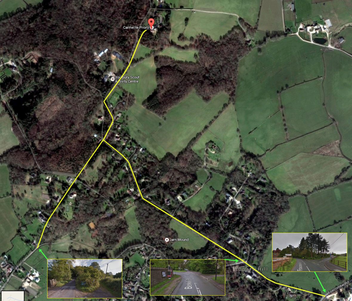
Directions via Hinksey Hill roundabout, approaching the Priory from the east
This roundabout is easy to find, and can be reached from all directions (there is another route, if travelling from the North, or the north of Oxford, which may be easier when you reach the private roads, as it has fewer confusing junctions on the private road – see further down this page):
FROM BIRMINGHAM
Take M40 until junction 9 (sign – Oxford/Newbury). Take A34 and stay on A34 until Hinksey Hill interchange. Then take 3rd exit from roundabout (sign – Boars Hill) and follow the brown signs for the Scout Camp. NB. Should you miss the exit from A34, you may also take the next exit Abingdon North (A4183) and turn immediately right after leaving A34 (sign – Boars Hill, Sunningwell).
FROM NEWBURY
Take A34 until Hinksey Hill interchange (sign – Oxford Ring Road). Then take the first exit at roundabout (sign – Boars Hill) and follow the brown signs for the Scout Camp.
FROM LONDON
Take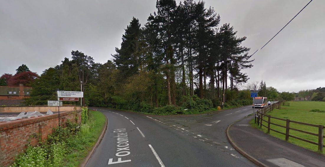 M40 to junction 8 (sign – Oxford). Take Oxford ring road, south and west (signs – Cowley, then Abingdon). Stay on ring rod until you come to the junction with A34 (Hinksey Hill interchange). Then take 2nd exit from roundabout (signs – Boars Hill) and follow brown signs for the Scout Camp. After 1.7 miles from Hinksey roundabout, you will turn right at the sign to Old Boars Hil / Youlbury.
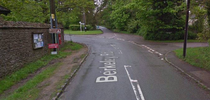
About a third of a mile further on, at this junction, keep straight on, down the private road (Ridgeway). Follow the Ridgeway to the crossroads at the end, where you turn right and follow that lane to the Priory, passing the Scout camp on your left on the way.
Alternative route, going around Boars Hill to the west, via Cumnor
(if you are arriving from the north side of Oxford, which may be easier because when you reach the private road it has fewer confusing junctions:
Take M40 until junction 9 (sign – Oxford/Newbury). Take A34 and stay on A34 until the sign for North Hinksey (Botley), where you take the slip road following a sign to Oxford A420. At the roundabout, take the 3rd exit, to Cumnor (A420). Follow the A420 for 2 miles and turn off at the sign for Abingdon/Cumnor B4017. At the T-junction, turn right towards Cumnor. Bear left at the next junction to follow the B4017 for 1.7 miles and turn left at a crossroads where a finger post points to Wootton and Old Boars Hill. This lane is called Wootton Village – follow it until it ends at a fork, where you bear left, on to the private road (Sandy Lane).
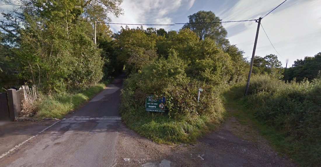
Follow Sandy lane to the Priory, passing the Scout camp on your left on the way.
Upcoming Events
<li>No events in this location</li>